A new interactive map of global wind patterns is mind blowing (pun intended).
As reported widely in the media over the last few days, Cameron Beccario, a software engineer working out of Tokyo created an interactive map of global wind patterns – simply called ‘Earth’.
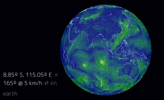
The data used for this marvellous display is from The Global Forecast System (part of the US National Weather Service).
Watching the wind patterns moving to and fro, depicting gentle winds in green, strong winds in yellow, and storms in thick red/purple is fascinating and addictive! Plus you can see hurricanes and cyclones in the making – watch out for the whirls as shown to the West of Australia on this sample image taken at the time of writing. They depict tropical cyclones Bruce and Amara and that’s most likely the reason for having experienced a deluge in parts of the Indonesian Archipelago today.
Just zoom into the globe and turn it with your mouse – it will definitely keep you occupied…

Comments are closed.